I remember standing on a sodden ridge in the Cairngorms back in 2012, my notebook getting more waterlogged by the minute, trying to log a pair of peregrines while my boots leaked through. People often think that understanding how citizen science surveys work requires some high-level academic clearance or a degree in statistical modeling to be useful. They see these massive, data-driven projects and assume they’re just bystanders. But after twenty years of counting nesting birds in horizontal rain, I can tell you that the science doesn’t actually live in a lab; it lives in the grit and the observation of someone standing in the mud, noticing the small things that a satellite or a single researcher could never catch.
I’m not here to give you a lecture on theoretical frameworks or academic jargon. Instead, I’m going to pull back the curtain on the actual mechanics of the process—from the way a protocol is designed to the way your single sighting becomes a data point in a decade-long trend. I will tell you exactly what makes a survey actually work in the field and where the common pitfalls lie, so you can stop guessing and start contributing something that matters.
Table of Contents
Reliable Biodiversity Monitoring Techniques for the Unpredictable Field
Reliable biodiversity monitoring techniques for the unpredictable field
When you’re out on a ridge and the wind starts picking up, you don’t have time for a complicated manual. Effective biodiversity monitoring techniques in the real world have to be rugged and, more importantly, repeatable. I’ve spent years logging raptor sightings, and I’ve learned that the best methods are the ones that don’t fall apart when your fingers are numb or the visibility drops to ten meters. Whether it’s a simple transect walk or a fixed-point count, the method needs to be simple enough that a tired volunteer can execute it accurately without second-guessing their position.
The real challenge isn’t just seeing the bird; it’s the scientific data validation that happens after you get back to the warmth of the pub. We rely on community-based research participation to cover vast amounts of ground that a single professional team never could, but that only works if the observations are consistent. If one person is counting every individual sparrow and another is only noting the most obvious ones, the data becomes noise. That’s why the training matters—it’s not about being a scientist, it’s about being disciplined enough to follow the protocol when the weather turns.
Why Scientific Data Validation Is More Than Just a Guess
When I was a ranger, I spent half my time fixing paths and the other half trying to explain to hikers why a “quick look” at a nesting site wasn’t actually a scientific observation. There is a massive difference between seeing a bird and actually recording it in a way that a researcher can use three years later. This is where scientific data validation becomes the backbone of the whole operation. Without it, you aren’t building a database; you’re just collecting a pile of anecdotes.
If a volunteer logs a Peregrine falcon in a habitat where they simply don’t occur, the entire dataset for that region gets skewed. That’s why volunteer researcher training is so much more important than the actual tech or apps being used. It isn’t about memorizing every species name in the handbook; it’s about understanding the rigor required to ensure the information is accurate. We need people who understand that a “maybe” is often more useful than a confident but wrong guess. Real science relies on the boring, repetitive work of verifying what we think we’ve seen.
Five Ways to Make Sure Your Data Doesn't End Up in the Bin

- Record the context, not just the creature. I’ve seen plenty of logs that say “Peregrine spotted,” but omit the fact that it was a gale-force wind and a heavy mist. A bird sighting without the weather, the time of day, and the specific habitat description is just a story, not data.
- Accept that your “failure” to see anything is still a result. If you spend four hours on a ridge looking for a specific raptor and see absolutely nothing, that is a vital piece of information. Don’t just go home and leave the log blank; record the effort and the lack of sightings. That’s how we map absence.
- Consistency beats intensity every single time. I’d much rather have a volunteer walk the same three-kilometre stretch of footpath once a month for a year than have someone spend an entire week doing a massive, one-off blitz. Patterns emerge from repetition, not from sporadic bursts of enthusiasm.
- Use the tools you actually know how to use. I’ve carried every GPS unit and field app under the sun over the last twenty years, and I’ve learned that if a piece of kit is too fiddly to use while your fingers are numb or it’s raining sideways, you won’t use it properly. If the survey method is too complex for real-world conditions, the data will be sloppy.
- Learn to distinguish between a “maybe” and a “definitely.” In my job, being “pretty sure” about a weather window can get people hurt; in citizen science, being “pretty sure” about a species can skew an entire population model. If you aren’t certain, use the designated “uncertain” or “unidentified” categories. It’s better to be honest about a doubt than to provide a false certainty.
The Gap Between a Sighting and a Data Point
“A survey isn’t just a checklist of what you saw while you were out for a walk; it’s the discipline of recording what you didn’t see, exactly where you expected to see it, even when the weather is turning and you’d rather be back at the van. Real data lives in that gap between an optimistic guess and the cold, hard reality of a verified observation.”
Bridget Halloran
The Reality of the Data
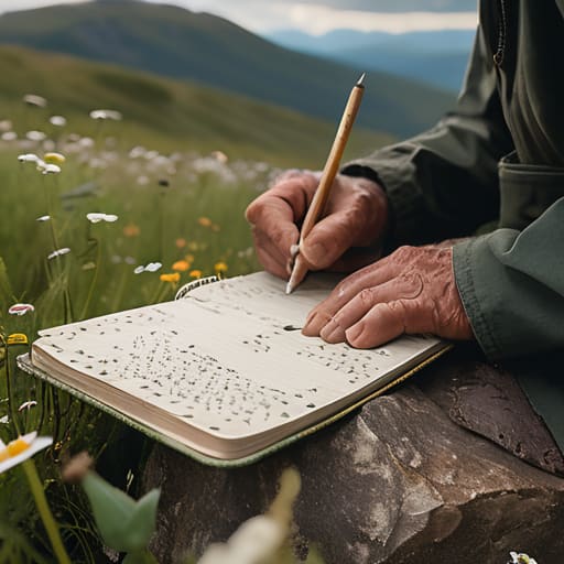
At the end of the day, citizen science isn’t about being a professional biologist; it’s about the discipline of the process. We’ve talked about why the methodology matters, why validation keeps the data from becoming noise, and why you have to be honest about what you’re seeing in the field. Whether you are counting nesting raptors in a gale or logging wildflowers on a dry ridge, the value lies in the consistency of your observations. If we want to understand how these habitats are shifting, we can’t rely on snapshots or guesses. We need the boring, repetitive, and sometimes uncomfortable work of systematic recording to build a picture that actually holds up under scientific scrutiny.
I’ve spent twenty-two years watching how quickly a landscape can change when we stop paying attention. The data we collect today is the only way we’ll know if the decisions we make tomorrow are actually working. It can feel small—just a single entry in a logbook or a pin on a map—but those individual points are the connective tissue of conservation. Don’t wait for perfect conditions or a PhD to get involved. Just get out there, keep your eyes open, and record what is actually happening, because the gap between knowing a species is declining and actually proving it is often just a person with a notebook and a bit of persistence.
Frequently Asked Questions
How do I know if my single sighting of a bird or insect is actually useful to a researcher, or if it's just noise?
It’s a fair question, and honestly, it’s the one that keeps researchers up at night. A single sighting isn’t “noise” if it’s documented with context. If you just log “Red Kite,” it’s a data point without a spine. But if you log the time, the specific habitat—say, a limestone scree slope—and the weather conditions, you’ve given them something to work with. Context turns a fleeting moment into a usable piece of evidence.
What kind of gear or documentation do I actually need to make sure my observations aren't dismissed as guesswork?
You don’t need a lab, but you do need a system. I’ve carried the same Rite in the Rain notebook for twelve years; it’s survived three seasons of Lakeland sleet and hasn’t turned to pulp yet. Pair that with a decent pair of binoculars—I use my Swarovski Monarchs daily for raptor spotting—and a GPS to pin exact coordinates. If you can’t prove where you were and exactly what time you saw it, it’s just a story.
If I'm out on a long, solo trek in bad weather, how much of my data is considered "reliable" compared to a structured team survey?
If you’re solo and the weather turns, your priority is staying upright, not being a data point. A structured team uses “effort sampling”—standardized time and space—to ensure everyone is looking for the same thing in the same way. Your solo observation is a snapshot, often biased by your need to find shelter or move faster. It’s valuable context, but it lacks the rigor of a controlled survey. Don’t let a data log compromise your safety.